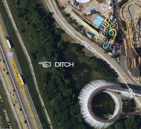
Aerial photo fetish
Not to be confused with an areola fetish. Google Maps is really fun! Now, which one is the real amusement park?
– Thanks to Shawn F for the tip.

Posted by: Kilwag (editor) on August 14th, 2008
Categories: Skate
Tags:
Not to be confused with an areola fetish. Google Maps is really fun! Now, which one is the real amusement park?
– Thanks to Shawn F for the tip.
Wow, that is actually a new ditch to me. I do not have goggle maps here to try to show you what I was talking about but that map is damn close. Washington street should be perpendicular to the Tri-State just south of that picture on the staight away of the roller coaster pictured. It may be in the trees? It would probably show up looking like a rectangle slab from a satelite shot.
I think I skated the ditch ShawnF is referring to way back in the 80’s during the Chicago Blowout vert contest (1986, I think…)
i still have chicago blowout on vhs–first skate vid ever bought by me. odeum?
Holy shit, Six Flags has changed since I worked there 79-84. Another wacky ditch we skated was along the exit ramp from Belvedere Road (120) to 2-94, it was a sloping half-pipe type thing. They added bumpy shit to it later. For those out in Rockford area, remember the “Perryville Pipeline”?
Wow TNJeff, I totally remember that part that you were talking about. Never realized this one.